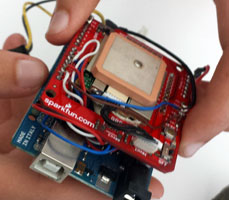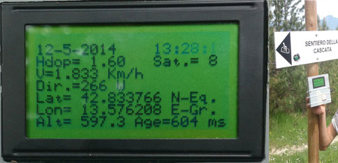
Le classi 4A IPAI (A.S. 2013-2014), 5A TIEN (A.S. 2013-2014) e 5A IPAI (2014-2015), coordinate dal prof. Franco Tufoni, hanno progettato e realizzato un GPS Tracker in grado di mappare i dati geografici (longitudine, latitudine, altitudine, ecc..) di un percorso escursionistico montano.
Il sistema è stato collaudato e testato con successo dalle classi su un percorso di 12 km a Colle San Marco.
Nell'Anno Scolastico in corso (2014-2015) il gruppo di lavoro formato da: Haxhiu Indrit, Zaporojanu Costantin e Mattioli Simone ha rielaborato il progetto e archiviato tutte le informazioni su questo sito Internet.
|

Classes 4 IPAI (school year 2013-2014), 5 A TIEN (school year 2013-2014) and 5A IPAI (school year 2014-2015), coordinated by their Electronics teacher, Mr Franco Tufoni, have designed and built a GPS Tracker that can map the geographical data (longitude, latitude, altitude, etc…) of a mountain hiking trail.
The system has been tried and successfully tested by the classes on a route of 12 Km on Colle San Marco.
In the current school year a work group, made up by Haxhiu Indrit, Zaporojanu Costantin e Mattioli Simone, has revised the project and stored all the information on this website.
|
|
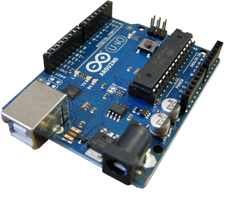
Il progetto è basato sul sistema di sviluppo Arduino ed integrato con componenti di recupero.
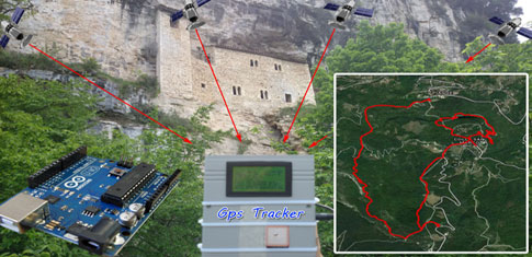
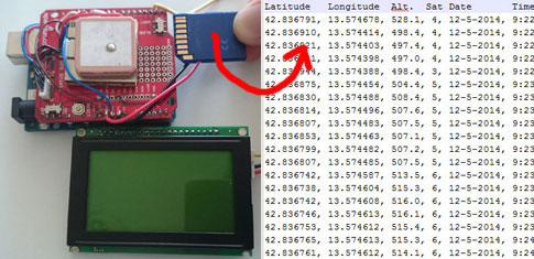
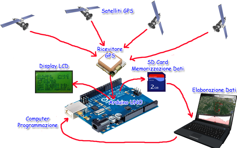
L'immagine riporta in sintesi gli elementi essenziali del progetto
Tra i componenti principali utilizzati troviamo: Arduino Uno, ricevitore GPS, Display LCD e memoria SD.
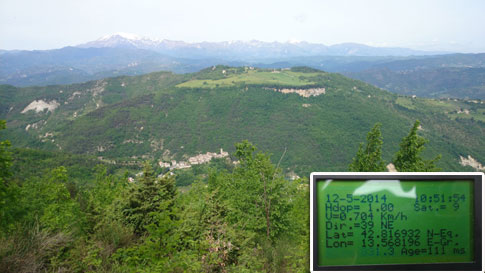
Il test è stato effettuato con successo il 12 maggio 2014 con partenza da Piagge di Ascoli Piceno e sviluppato all’interno del bosco toccando i fondamentali punti storico-culturali (Chiesa San Bartolomeo di Piagge, vista Eremo di San Giorgio e Castel Trosino, passo fonte del lupo, rifugio Paci, bosco dell’Impero, piano di San Marco, vecchia Mulattiera, eremo di San Marco, vecchia fornace, dito del diavolo, monastero di San Lorenzo, grotta del Beato Corrado e sacrario dei partigiani).
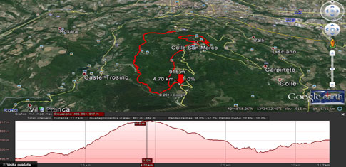
Durante il percorso, di 12 km, su un dislivello di 500 m e in circa 5 ore di cammino il GPS Tracker ha acquisito, elaborato e memorizzato sulla SD 3600 punti, uno ogni 5 secondi. I dati acquisiti sono stati inseriti su Google Earth e Google Maps per la ricostruzione grafica del percorso e confrontati con la mappa satellitare, si è riscontrata una grande precisione (dell’ordine del metro), precisione simile ad un GPS professionale. Nella Photo Gallery sono riportate tutte le fasi del progetto, dall'assemblaggio al collaudo.
Al progetto è stata data anche una forma multidisciplinare, è stata effettuata una sosta nei luoghi sopra indicati ed oltre alla memorizzazione dei dati tecnici, alcuni alunni hanno illustrato alle classi dati storico-culturali.
In conclusione possiamo dire che l'esperienza per gli allievi è stata formativa e costruttiva, attinente al programma scolastico ed ha consentito di trascorrere una giornata a contatto con la natura e conoscere alcuni luoghi dimenticati del territorio.
|
The project is based on the Arduino developing system and integrated with components of recovery.
The image shows a summary of the essential elements of the project.
The main instruments used are: Arduino Uno, GPS receiver, LCD display and SD memory card.
The test was successfully carried out on May 12th , 2014 starting from Piagge of Ascoli Piceno, and developed within the woods touching the fundamental historical and cultural points (St. Bartolomeo Church of Piagge, San Giorgio and Castel Trosino, the Source of the Wolf pass, the Paci Shelter, the San Marco plain, the old Mule, the Hermitage of San Marco, the old Furnace, the Finger of the devil, the monastery of San Lorenzo, the cave of Blessed Corrado and the Shrine of the Partisans).
Along the way, 12 Km long, on a height difference of 500 m and in about 5 hours walk, the GPS Tracker has acquired, processed and stored on the SD card 3600 points, one every 5 seconds.
The acquired data were included on Google Earth and Google Maps for the graphic reconstruction of the route and, compared with the map, there has been a great precision (of the order of a meter), exactly like a professional GPS. The Photo Gallery shows all the project phases, from assembly to testing.
The project was also given a multidisciplinary form: there was always a stop in the places mentioned above and, besides storing the technical data, some students have collected and shown their classes the historical and cultural information.
In conclusion we can say that the experience was formative and constructive for students, relevant to their curriculum, and it made it possible to spend a day in contact with nature and some forgotten places of the territory
|

